On August 1st, 1876, Colorado became the 38th star on the American flag. The Centennial State was born in the year of the nation’s own centennial. 150 years later, five photographs tell the story of what our state grew into.
A photograph holds a moment in time, brings back memories, and waits for someone to look at it. We gathered five images from the archives of History Colorado’s collection, taken across six decades of Colorado life, from 1892 to 1960. Together, they tell the story better than a highlight reel and create a portrait of a state still finding its shape, negotiating between wilderness and civilization, remaining unknown and being celebrated for its natural beauty.
As Colorado marks 150 years of statehood, these photographs implore us to look back and look closely at the people who built our state and made it what it is today.
The Colorado Mountain Club
In 1917, the world was at war, but in Pitkin County, a group of hikers paused beside a cliff. The county is home to six Fourteeners, the Maroon Bells, and a silver mining past that shaped the entire Western Slope. It was a place of enormous physical consequence, and its future as a world-class ski destination was still 30 years away.

Founded in 1912, the Colorado Mountain Club (CMC) had grown remarkably fast. What started with 25 charter members became an organization of hundreds, and eventually thousands, committed to the idea that the mountains of Colorado belonged not only to the few but to anyone willing to climb them.
Within two years of its founding, the club championed the congressional legislation that established Rocky Mountain National Park. The CMC didn’t just explore the wilderness; it argued that the wilderness was worth saving. Today, the organization is headquartered in Golden, Colorado, and has approximately 7,500 members.
City and Summit
If you stood on the roof of a church in Denver in the late nineteenth century and looked west, you would see something almost no other American city could offer: a wall of mountains, snow-capped in June, seemingly close enough to touch.
This was Denver just after its church-building boom, with the peak Mount Rosalie commanding the western skyline. Celebrated landscape painter Albert Bierstadt climbed what was then an unnamed peak in 1863 and suggested the name after Rosalie Osborne Ludlow.

Mount Rosalie was eventually rechristened Mount Evans after Colorado’s second territorial governor. The name Mount Roaslie was then transferred to its current 13er neighbor. Mount Evans carried a complicated history, and today the peak, located in Evergreen, is known as Mount Blue Sky.
Bierstadt immortalized the peak in an iconic painting, Storm in the Rocky Mountains, circa 1866, and now housed in the Brooklyn Museum.
Before the Lifts
Skiing in 1923 was not what it is today. Wooden skis, no poles, no groomed runs, and no trail map. Adventure seekers then were also pioneers for the mosern ski industry. Within Rocky Mountain National Park (RMNP) sits Notchtop Mountain, established in 1915 largely through the advocacy of the CMC.
The park began seeing skiers in the 1910s. Practiced by mail carriers, park rangers, and backcountry adventurers, they used skis for survival, not recreation. Skiing was a way to move through the snowy terrain when no other way existed.
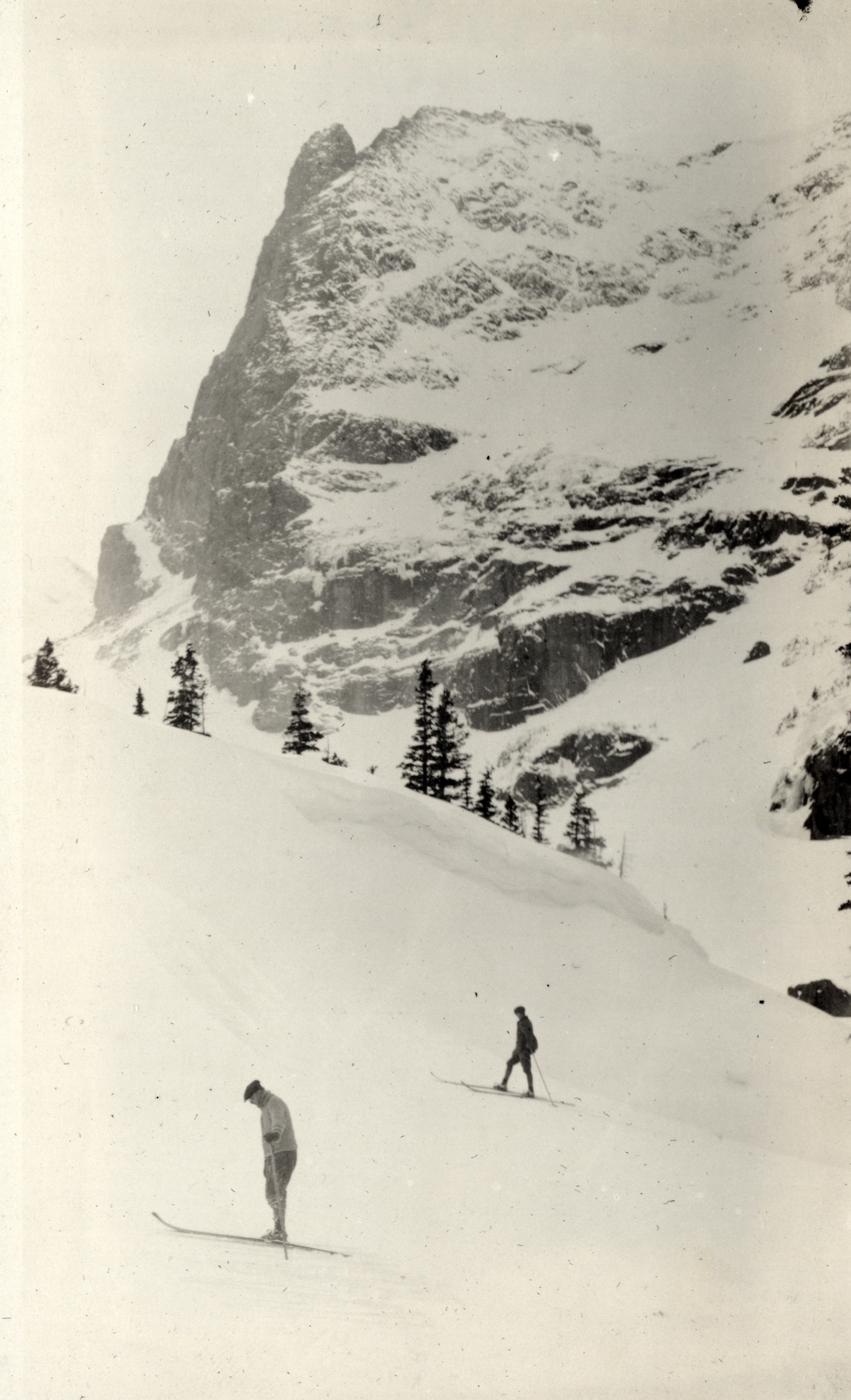
RMNP expanded quickly in the 1920s when roads were graded, and Trail Ridge Road was in the planning stages. The CMC organized wintertime outings to Fern Lake annually from 1916 – 1934, skiing routes that had no names and no safety nets.
Colorado’s first commercial ski area was Hidden Valley in the RMNP, opening in 1955.
What this photograph preserves is the brief moment in time when wilderness and recreation collided, and those willing to tackle the mountains step by step, turn by turn, in the freezing cold were handsomely rewarded.
Telluride in its Golden Age
Founded in the 1870s after prospectors staked claims for silver, Telluride reached peak confidence in 1902. In this photograph from the town’s Main Street, Colorado Avenue, we see brick storefronts, wide streets, tall facades, and the New Sheridan Hotel, constructed in 1891 and still in business today as a historic boutique hotel.
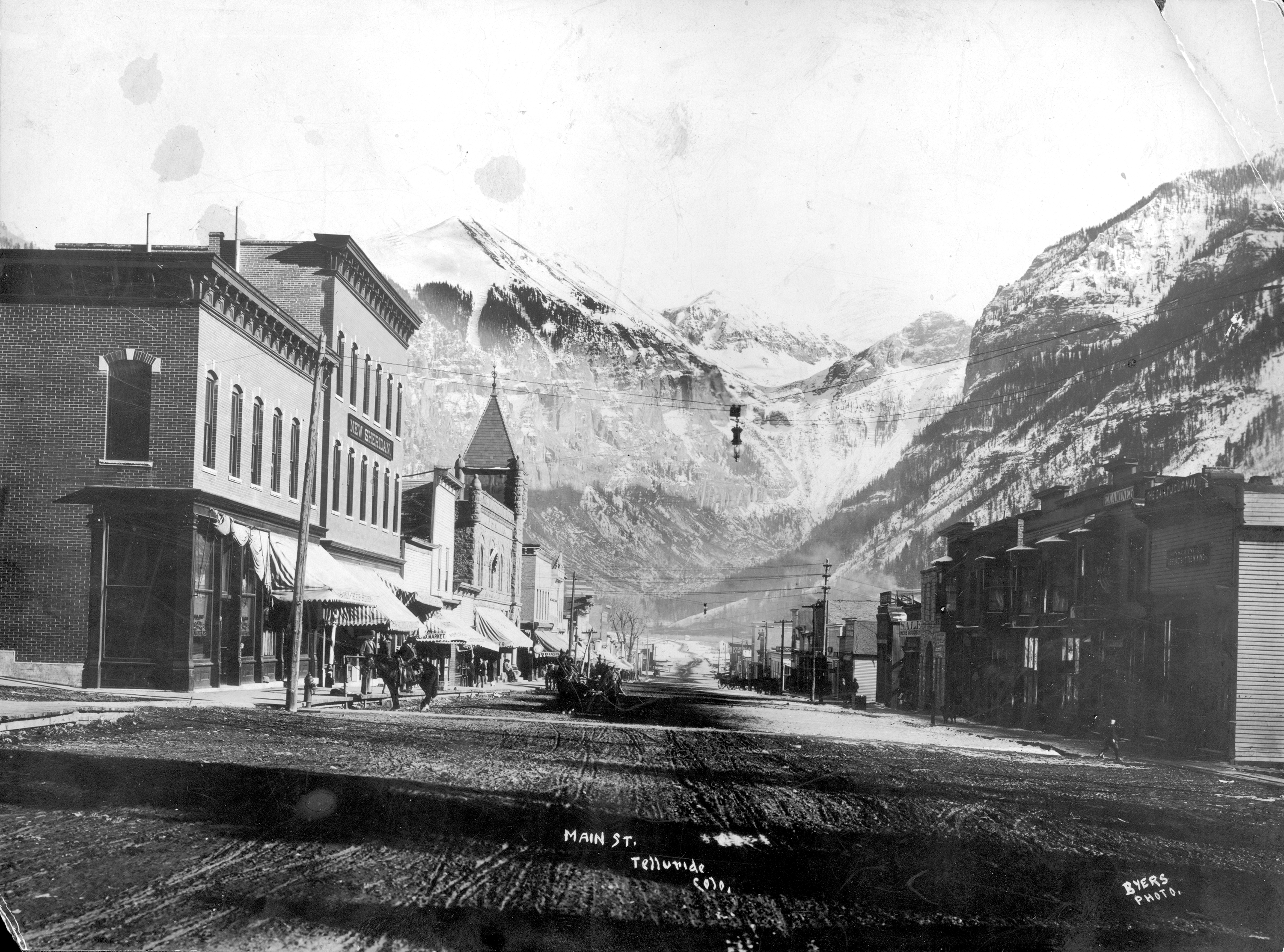
Additionally, a mainstay and built to rival the grand establishments in New York and Chicago, the Sheridan Opera House started as a vaudeville theater in 1913. Today, the theater is an intimate 238-seat venue on the National Register of Historic Places and home to the Sheridan Arts Foundation (SAF).
Telluride’s main street is indicative of the immigrant laborers from Italy, Austria, Ireland, and Finland, working long shifts in mines. This defiant ambition set the stage for Telluride’s popularity today, and Colorado Avenue’s distinction as a National Historic Landmark means this photograph looks remarkably the same today.
The Road Over the Divide
At 11,990 feet above sea level, Loveland Pass straddles the Continental Divide. That long spine of the Rocky Mountains separates the waters flowing east toward the Atlantic from those flowing west toward the Pacific. To stand at its summit is to stand at a hinge of the continent. To drive over it, which became possible only in the early 1930s, was to experience Colorado’s beauty and the danger it holds: the audacious engineering, the hairpin switchbacks, the sudden exposure to sky, and the question of whether the road would hold.
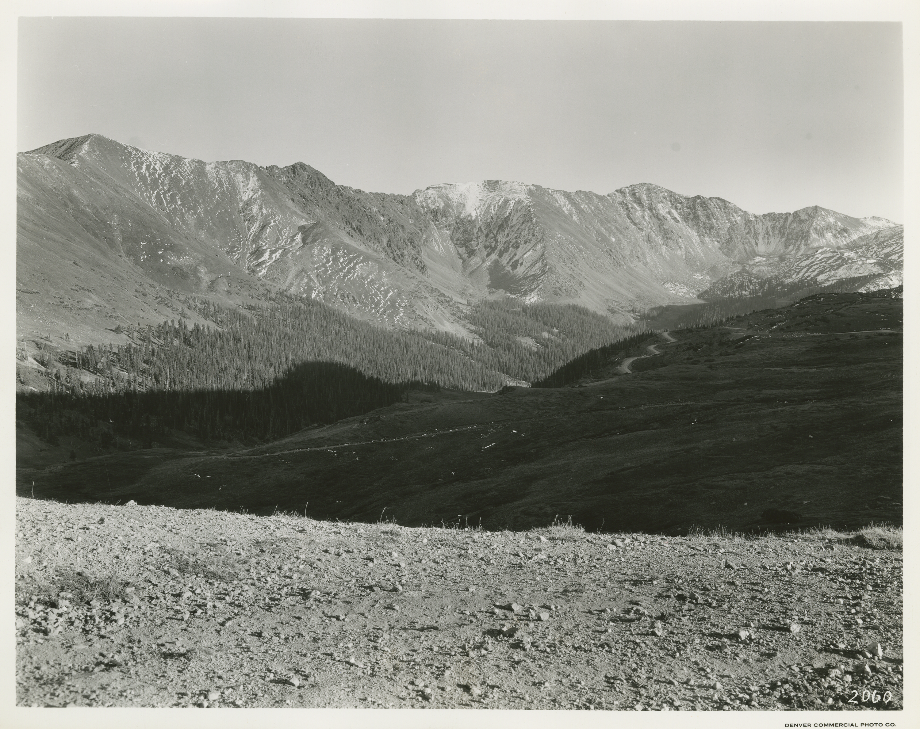
The pass is named for William A.H. Loveland, president of the Colorado Central Railroad, who built the original wagon road over it in 1879 to connect Denver to the mining towns. Fully paved in 1950, the road transitioned from a rough road to a smooth highway. Before the Eisenhower-Johnson Memorial Tunnel opened in 1973, Loveland Pass was the only way west.
This photograph was taken somewhere in the long span between the New Deal highway projects and the mid-century boom that followed World War II. It represents the pass in its elemental form: the road, the sky, the drop, and the silence. Today, the pass is a popular drive or hike through the Rocky Mountains, and is often used as an alternate route to I-70.
As we celebrate our state’s history, let us focus on the immense beauty that draws visitors and residents alike. Honoring the mountains that were climbed, the peaks that were named and renamed, the ski runs that were mapped, the towns that were built, and the roads that were paved allows us to relish in the sacrifices made and the beauty yet to come.